Croatia Control commissioned an Advanced – Surface Movement Guidance & Control System (A-SMGCS) at Franjo Tuđman Airport in Zagreb.
A-SMGCS is worth 4.4 million euro, with 85% of the amount being co-financed through the Connecting Europe Facility.
The system is very significant in low visibility conditions which are quite common at Franjo Tuđman Airport, and during which aerodrome air traffic controllers rely on the traffic situation as displayed via A-SMGCS.
When the recent aerodrome expansion and new traffic flows are taken into account, as well as the continued traffic growth, the complexity of airport operations, and simultaneous military and civil operations, the system plays a great role in raising the situational awareness of air traffic controllers to ensure the adequate safety level at Zagreb Airport in all weather conditions.
The implementation of the project has lasted for about three years, including the operational and technical implementation of the system, personnel licensing and training, building the infrastructure, and commercial and legal activities during the project.
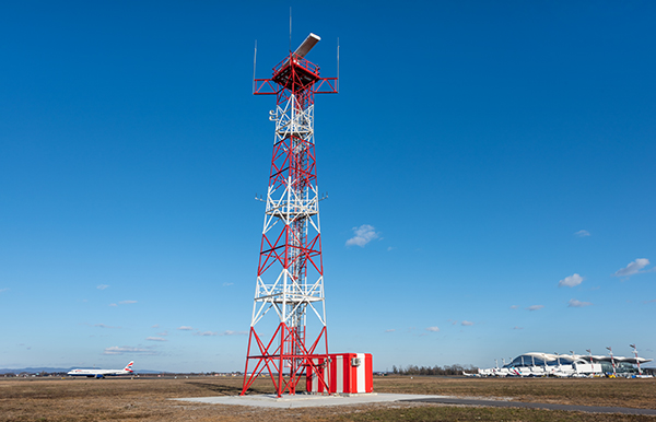
The system was produced and delivered by Saab. A-SMGCS is a state-of-the-art, technologically advanced solution, enabling traffic surveillance and control functions in the Zagreb Airport maneuvering area.
It includes a primary radar (SMR) and a multilateration system (MLAT). The SMR is a relatively low-power and short-range radar used to detect all aircraft, vehicles, and other objects on the airport surface with an important safety role, since it detects all traffic, no matter if the vehicles are equipped with a transponder or operating properly.
On the other hand, the MLAT system relies on aircraft and vehicle equipment, i.e. transponders which have to be properly used and fully operational. Unlike the SMR, the MLAT system additionally provides information on aircraft identification, which is contained in the emitted transponder signal. This system consists of multiple receivers, spatially distributed around the runway, receiving signals emitted by an aircraft. Based on those signals and the time difference between receiving them, a data processing system calculates the precise position of the aircraft.